[vc_row][vc_column][mpc_connected_icons preset=”mpc_preset_9″ content_preset=”_mpc_preset_1″ layout=”vertical” gap=”25″ lines_number=”2″ lines_style=”dotted” lines_color=”#365347″ lines_gap=”2″ lines_weight=”3″][mpc_icon_column layout=”style_3″ alignment=”left” background_color=”#ffffff” padding_css=”padding:0px;” margin_divider=”true” title_font_preset=”mpc_preset_20″ title_font_color=”#365347″ title_font_size=”17″ title_font_line_height=”1.4″ title_font_transform=”uppercase” title_font_align=”left” title=”DAY 1: TREKKING FROM MARANGU GATE TO MANDARA HUT” title_margin_divider=”true” title_margin_css=”margin-bottom:5px;” content_font_preset=”mpc_preset_1″ content_font_color=”#0a0a0a” content_font_size=”16″ content_font_line_height=”1.5″ content_font_align=”left” mpc_icon__icon_type=”image” mpc_icon__icon_image_size=”full” mpc_icon__icon_image=”3688″ mpc_icon__border_css=”border-radius:0px;” mpc_icon__padding_divider=”true” mpc_icon__margin_divider=”true” mpc_icon__margin_css=”margin-right:15px;” mpc_icon__mpc_tooltip__border_divider=”true” mpc_icon__mpc_tooltip__padding_divider=”true” mpc_divider__disable=”false” mpc_divider__width=”10″ mpc_divider__align=”left” mpc_divider__content_padding_divider=”true” mpc_divider__content_padding_css=”padding-top:0px;padding-right:0px;padding-bottom:0px;padding-left:0px;” mpc_divider__lines_color=”#dddddd” mpc_divider__padding_divider=”true” mpc_divider__padding_css=”padding-top:3px;padding-bottom:3px;” hover_padding_css=”padding:0px;”]
Change in Elevation:
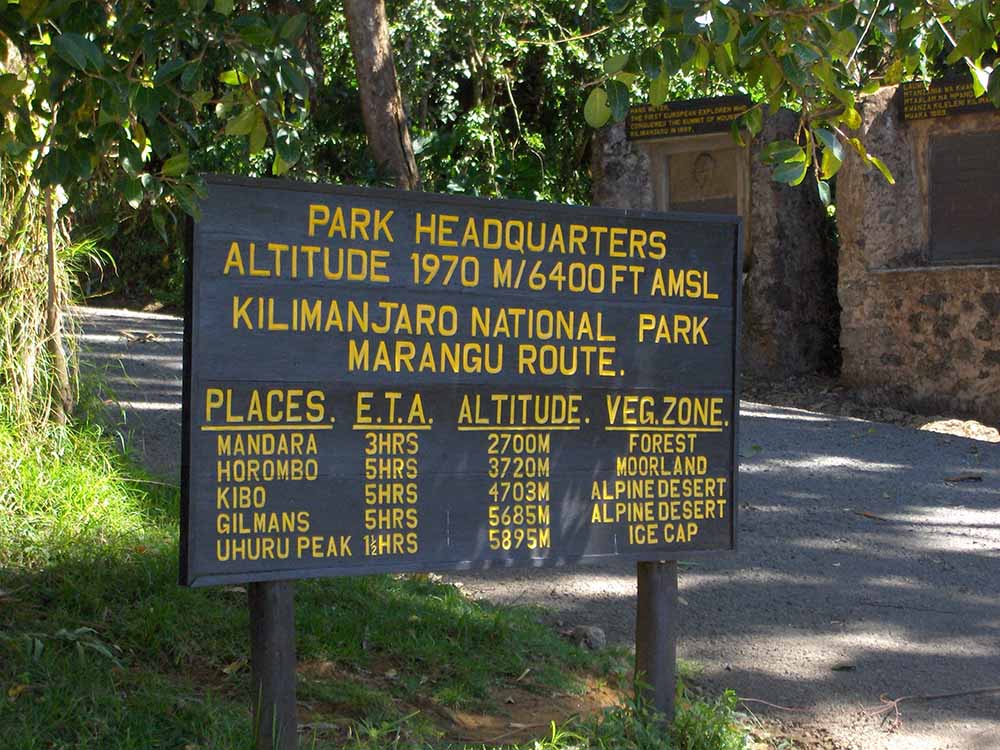
- Marangu Gate (1,860 m)
- Mandara Hut (2,700 m)
- Hiking distance: 11 km
- Hiking time: 5 to 7 hours
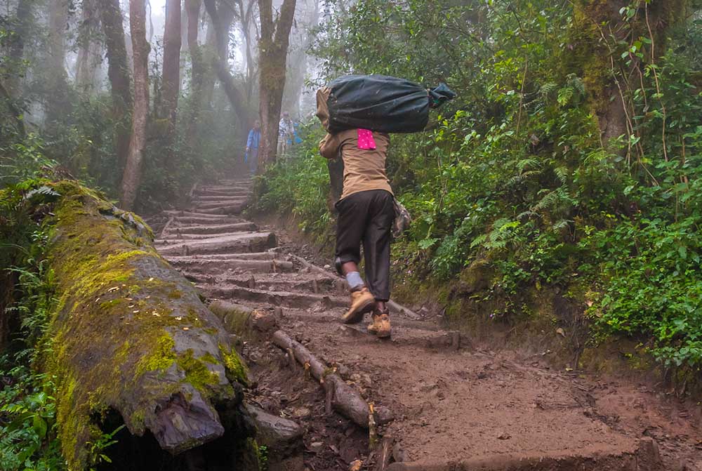
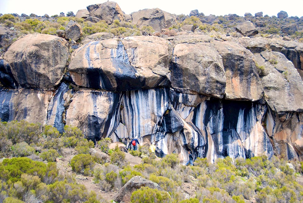
A guide and a mountain support crew will arrive at the hotel in the morning in order to meet you and hold a quick briefing, after which you will travel by vehicle to Kilimanjaro National Park’s eastern entrance: Marangu Gate (1,860 m). After the quick formality of acquiring climbing permits and registering with the search and rescue service, the group will start trekking up to Mandara Hut (2,700 m). The trekking route includes passage through the rainforest (where tropical showers are highly probable), so we recommend you take not only spare clothes, but also your raincoats. When you reach the camp, our mountain support crew will take care of the necessities, pitch the tents, and prepare lunch.
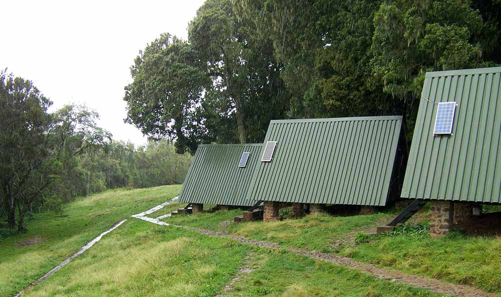
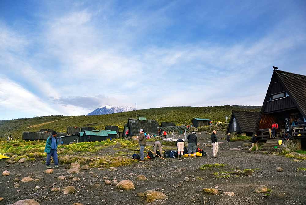
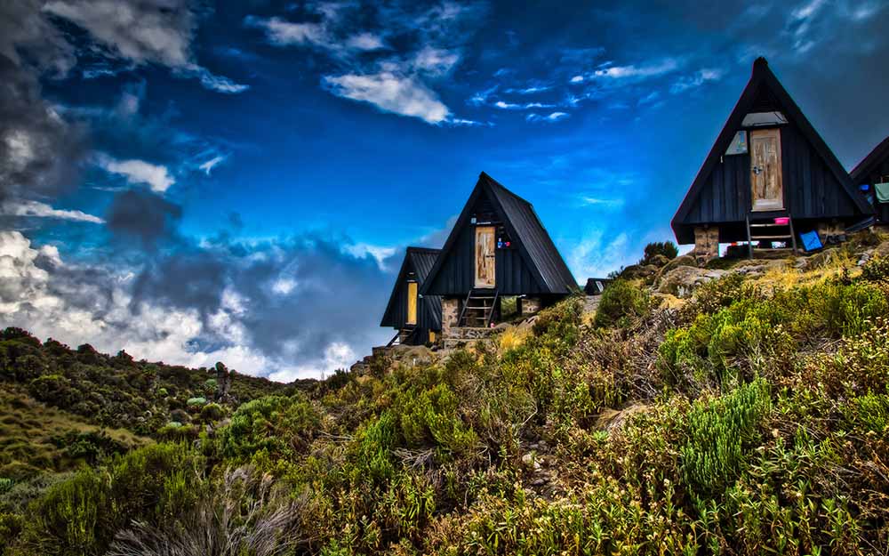
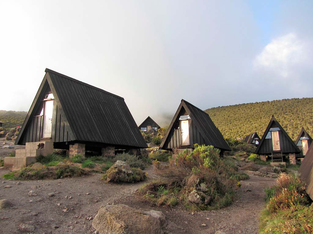
Throughout the entire Marangu route, you will be spending your nights in special huts. They offer a great alternative to those who do not want to sleep in tents.
This will be your first day at this altitude, so it is strongly recommended you heed the following instructions from this point on:
- Abstain from consuming alcohol and caffeine
- Drink over 4 liters of bottled water daily (little by little, frequently)
- Take a Diamox pill to help alleviate symptoms of altitude sickness. Most mountain climbers take Diamox in the morning, before they start their ascent, in order to reduce discomfort associated with altitude sickness. We recommend you consult your doctor prior to the trip in case of potential allergies.
At night you may experience discomfort associated with acclimatization to the high altitude: because of a reduction in your waking breathing pattern, your body gets less oxygen than during the day. Taking altitude into account, you may therefore start feeling sick and have a headache. Pay attention to your own body and tell your guide if you start feeling any symptoms of altitude sickness.[/mpc_icon_column][mpc_icon_column layout=”style_3″ alignment=”left” background_color=”#ffffff” padding_css=”padding:0px;” margin_divider=”true” title_font_preset=”mpc_preset_20″ title_font_color=”#365347″ title_font_size=”17″ title_font_line_height=”1.4″ title_font_transform=”uppercase” title_font_align=”left” title=”DAY 2: TREKKING FROM MANDARA HUT TO HOROMBO HUT” title_margin_divider=”true” title_margin_css=”margin-bottom:5px;” content_font_preset=”mpc_preset_1″ content_font_color=”#0a0a0a” content_font_size=”16″ content_font_line_height=”1.5″ content_font_align=”left” mpc_icon__icon_type=”image” mpc_icon__icon_image_size=”full” mpc_icon__icon_image=”3688″ mpc_icon__border_css=”border-radius:0px;” mpc_icon__padding_divider=”true” mpc_icon__margin_divider=”true” mpc_icon__margin_css=”margin-right:15px;” mpc_icon__mpc_tooltip__border_divider=”true” mpc_icon__mpc_tooltip__padding_divider=”true” mpc_divider__disable=”false” mpc_divider__width=”10″ mpc_divider__align=”left” mpc_divider__content_padding_divider=”true” mpc_divider__content_padding_css=”padding-top:0px;padding-right:0px;padding-bottom:0px;padding-left:0px;” mpc_divider__lines_color=”#dddddd” mpc_divider__padding_divider=”true” mpc_divider__padding_css=”padding-top:3px;padding-bottom:3px;” hover_padding_css=”padding:0px;”]
Change in Elevation:
- Mandara Hut (2,700 m)
- Horombo Hut (3,720 m)
- Hiking distance: 10 km
- Hiking time: 5 to 6 hours
Early in the morning after breakfast, the group will depart Mandara Hut to start a moderate trek towards the second high altitude camp: Horombo Hut (3,720 m). When you reach the camp on this day, you will be treated to views of two volcanos at once: Kibo and Mawenzi.
Several hours after lunch you will have to complete an acclimatization hike in the direction of Kibo Hut with a 200-meter gain in altitude, and then hike back down to Horombo Hut where dinner will be prepared for you.
Note: The acclimatization hike is an easy trek with a slight gain in altitude done in order to speed up the acclimatization process. You should take the acclimatization hikes very seriously. They help increase your chances of successfully summiting Kilimanjaro and save you from the consequences of altitude sickness.
Acclimatization hike:
Change in Elevation:
- Horombo Hut (3,720 m)
- Destination point en route to Kibo Hut (3,920 m)
- Hiking distance: 2.5 km
- Hiking time: 1 to 2 hours
[/mpc_icon_column][mpc_icon_column layout=”style_3″ alignment=”left” background_color=”#ffffff” padding_css=”padding:0px;” margin_divider=”true” title_font_preset=”mpc_preset_20″ title_font_color=”#365347″ title_font_size=”17″ title_font_line_height=”1.4″ title_font_transform=”uppercase” title_font_align=”left” title=”DAY 3: TREKKING FROM HOROMBO HUT TO KIBO HUT” title_margin_divider=”true” title_margin_css=”margin-bottom:5px;” content_font_preset=”mpc_preset_1″ content_font_color=”#0a0a0a” content_font_size=”16″ content_font_line_height=”1.5″ content_font_align=”left” mpc_icon__icon_type=”image” mpc_icon__icon_image_size=”full” mpc_icon__icon_image=”3688″ mpc_icon__border_css=”border-radius:0px;” mpc_icon__padding_divider=”true” mpc_icon__margin_divider=”true” mpc_icon__margin_css=”margin-right:15px;” mpc_icon__mpc_tooltip__border_divider=”true” mpc_icon__mpc_tooltip__padding_divider=”true” mpc_divider__disable=”false” mpc_divider__width=”10″ mpc_divider__align=”left” mpc_divider__content_padding_divider=”true” mpc_divider__content_padding_css=”padding-top:0px;padding-right:0px;padding-bottom:0px;padding-left:0px;” mpc_divider__lines_color=”#dddddd” mpc_divider__padding_divider=”true” mpc_divider__padding_css=”padding-top:3px;padding-bottom:3px;” hover_padding_css=”padding:0px;”]
Change in Elevation:
- Horombo Hut (3,720 m)
- Kibo Hut (4,700 m)
- Hiking distance: 10 km
- Hiking time: 4 to 8 hours
On this day, right after breakfast the group will be trekking to the Kibo Hut (4,700 m). The actual trekking is not very difficult, just remember to stick with an appropriate pace to keep up your strength for the trekking to Kilimanjaro’s summit. When you reach the camp you will be served lunch, after which we recommend you sleep as much as you can, avoid any strenuous activity, and drink lots of water.[/mpc_icon_column][mpc_icon_column layout=”style_3″ alignment=”left” background_color=”#ffffff” padding_css=”padding:0px;” margin_divider=”true” title_font_preset=”mpc_preset_20″ title_font_color=”#365347″ title_font_size=”17″ title_font_line_height=”1.4″ title_font_transform=”uppercase” title_font_align=”left” title=”DAY 4: TREKKING TO UHURU PEAK AND DESCENT TO HOROMBO HUT” title_margin_divider=”true” title_margin_css=”margin-bottom:5px;” content_font_preset=”mpc_preset_1″ content_font_color=”#0a0a0a” content_font_size=”16″ content_font_line_height=”1.5″ content_font_align=”left” mpc_icon__icon_type=”image” mpc_icon__icon_image_size=”full” mpc_icon__icon_image=”3688″ mpc_icon__border_css=”border-radius:0px;” mpc_icon__padding_divider=”true” mpc_icon__margin_divider=”true” mpc_icon__margin_css=”margin-right:15px;” mpc_icon__mpc_tooltip__border_divider=”true” mpc_icon__mpc_tooltip__padding_divider=”true” mpc_divider__disable=”false” mpc_divider__width=”10″ mpc_divider__align=”left” mpc_divider__content_padding_divider=”true” mpc_divider__content_padding_css=”padding-top:0px;padding-right:0px;padding-bottom:0px;padding-left:0px;” mpc_divider__lines_color=”#dddddd” mpc_divider__padding_divider=”true” mpc_divider__padding_css=”padding-top:3px;padding-bottom:3px;” hover_padding_css=”padding:0px;”]
Change in Elevation:
- Kibo Hut (4,700 m)
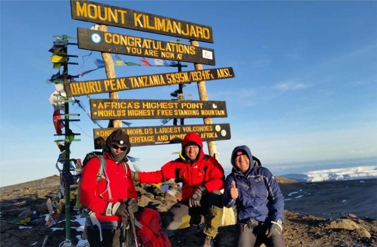
- Uhuru Peak (5,895 m)
- Horombo Hut (3,720 m)
- Hiking distance: 16 km
- Hiking time: 9 to 12 hours
Night departure from Kibo Hut (4,700 m) and the start of your trekking to Kilimanjaro’s summit: Uhuru peak (5,895 m). The trekking will be moderate from a physical standpoint, but the altitude presents a much more serious problem. For the entire length of the trekking each pair of climbers will be accompanied by their own guide, who will be monitoring your stamina and mental resolve. After your successful ascent to Uhuru Peak, you can descend to the nearest glacier if desired. Then you will return to Kibo Camp and after a two-hour rest continue your descent to Horombo Hut (3,720 m).
Note: Don’t forget that 90% of all accidents occur during the descent, including all broken arms and legs. Please pay attention to your feet, as there is a high risk of damaging your toenails.[/mpc_icon_column][mpc_icon_column layout=”style_3″ alignment=”left” background_color=”#ffffff” padding_css=”padding:0px;” margin_divider=”true” title_font_preset=”mpc_preset_20″ title_font_color=”#365347″ title_font_size=”17″ title_font_line_height=”1.4″ title_font_transform=”uppercase” title_font_align=”left” title=”DAY 5: DESCENT FROM HOROMBO HUT TO MARANGU GATE” title_margin_divider=”true” title_margin_css=”margin-bottom:5px;” content_font_preset=”mpc_preset_1″ content_font_color=”#0a0a0a” content_font_size=”16″ content_font_line_height=”1.5″ content_font_align=”left” mpc_icon__icon_type=”image” mpc_icon__icon_image_size=”full” mpc_icon__icon_image=”3688″ mpc_icon__border_css=”border-radius:0px;” mpc_icon__padding_divider=”true” mpc_icon__margin_divider=”true” mpc_icon__margin_css=”margin-right:15px;” mpc_icon__mpc_tooltip__border_divider=”true” mpc_icon__mpc_tooltip__padding_divider=”true” mpc_divider__disable=”false” mpc_divider__width=”10″ mpc_divider__align=”left” mpc_divider__content_padding_divider=”true” mpc_divider__content_padding_css=”padding-top:0px;padding-right:0px;padding-bottom:0px;padding-left:0px;” mpc_divider__lines_color=”#dddddd” mpc_divider__padding_divider=”true” mpc_divider__padding_css=”padding-top:3px;padding-bottom:3px;” hover_padding_css=”padding:0px;”]
Change in Elevation:
- Horombo Hut (3,720 m)
- Marangu Gate (1,860 m)
- Hiking distance: 18 km
- Hiking time: 5 to 6 hours
You will be offered a warm breakfast in the morning, after which we will head for the Kilimanjaro National Park’s exit: Marangu Gate (1,860 m). After your descent the whole group will gather to congratulate you, and then you will have the chance to share your opinions on the trip in the guestbook. Lastly, we will present you with your commemorative certificates (in our office) and provide you a transfer back to the hotel.[/mpc_icon_column][mpc_icon_column layout=”style_3″ alignment=”left” background_color=”#ffffff” padding_css=”padding:0px;” margin_divider=”true” title_font_preset=”mpc_preset_20″ title_font_color=”#365347″ title_font_size=”17″ title_font_line_height=”1.4″ title_font_transform=”uppercase” title_font_align=”left” title=”OPTIONAL DAY” title_margin_divider=”true” title_margin_css=”margin-bottom:5px;” content_font_preset=”mpc_preset_1″ content_font_color=”#0a0a0a” content_font_size=”16″ content_font_line_height=”1.5″ content_font_align=”left” mpc_icon__icon_type=”image” mpc_icon__icon_image_size=”full” mpc_icon__icon_image=”3688″ mpc_icon__border_css=”border-radius:0px;” mpc_icon__padding_divider=”true” mpc_icon__margin_divider=”true” mpc_icon__margin_css=”margin-right:15px;” mpc_icon__mpc_tooltip__border_divider=”true” mpc_icon__mpc_tooltip__padding_divider=”true” mpc_divider__disable=”false” mpc_divider__width=”10″ mpc_divider__align=”left” mpc_divider__content_padding_divider=”true” mpc_divider__content_padding_css=”padding-top:0px;padding-right:0px;padding-bottom:0px;padding-left:0px;” mpc_divider__lines_color=”#dddddd” mpc_divider__padding_divider=”true” mpc_divider__padding_css=”padding-top:3px;padding-bottom:3px;” hover_padding_css=”padding:0px;”]
Spend an Extra day at Horombo Hut (3720m) for better acclimatization.
[/mpc_icon_column][/mpc_connected_icons][/vc_column][/vc_row]