[vc_row][vc_column][mpc_connected_icons preset=”mpc_preset_9″ content_preset=”_mpc_preset_1″ layout=”vertical” gap=”25″ lines_number=”2″ lines_style=”dotted” lines_color=”#365347″ lines_gap=”2″ lines_weight=”3″][mpc_icon_column layout=”style_3″ alignment=”left” background_color=”#ffffff” padding_css=”padding:0px;” margin_divider=”true” title_font_preset=”mpc_preset_20″ title_font_color=”#365347″ title_font_size=”17″ title_font_line_height=”1.4″ title_font_transform=”uppercase” title_font_align=”left” title=”DAY 1: TREKKING FROM LONDOROSSI GATE TO SHIRA 1 CAMP” title_margin_divider=”true” title_margin_css=”margin-bottom:5px;” content_font_preset=”mpc_preset_1″ content_font_color=”#0a0a0a” content_font_size=”16″ content_font_line_height=”1.5″ content_font_align=”left” mpc_icon__icon_type=”image” mpc_icon__icon_image_size=”full” mpc_icon__icon_image=”3688″ mpc_icon__border_css=”border-radius:0px;” mpc_icon__padding_divider=”true” mpc_icon__margin_divider=”true” mpc_icon__margin_css=”margin-right:15px;” mpc_icon__mpc_tooltip__border_divider=”true” mpc_icon__mpc_tooltip__padding_divider=”true” mpc_divider__disable=”false” mpc_divider__width=”10″ mpc_divider__align=”left” mpc_divider__content_padding_divider=”true” mpc_divider__content_padding_css=”padding-top:0px;padding-right:0px;padding-bottom:0px;padding-left:0px;” mpc_divider__lines_color=”#dddddd” mpc_divider__padding_divider=”true” mpc_divider__padding_css=”padding-top:3px;padding-bottom:3px;” hover_padding_css=”padding:0px;”]
Change in Elevation:
- Lemosho Glades (3,500 m)
- Shira 1 Camp (3,505 m)
- Hiking distance: 5 km
- Hiking time: 1 to 2 hours
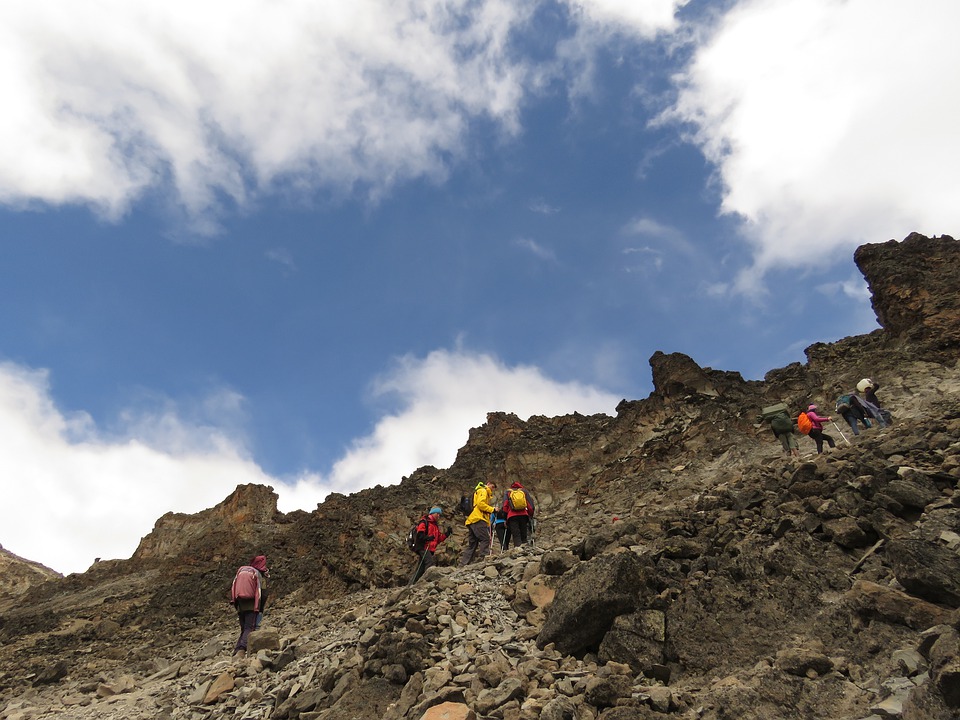
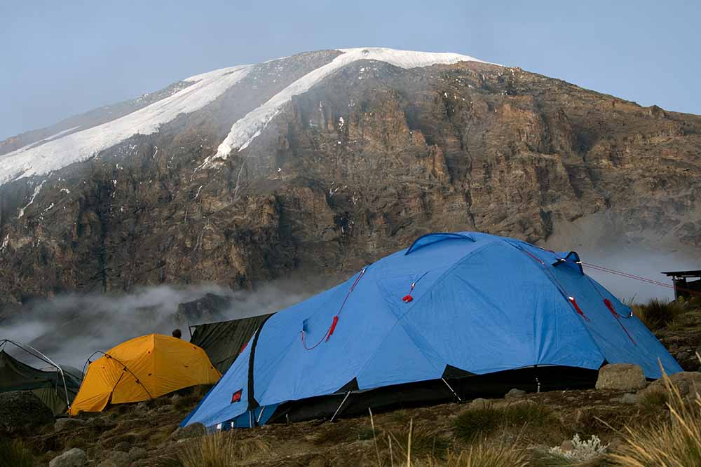
A guide and a mountain support crew will arrive at the hotel in the morning in order to meet you and hold another briefing, after which you will travel by vehicle (roughly 3 to 4 hours) to Kilimanjaro National Park’s western entrance: Londorossi Gate (2,200 m). After the quick formality of acquiring climbing permits and registering with the search and rescue service, the group continues upwards towards their drop off point by off-road vehicles (reaching 3,500 meters). Here you can see stunning views of the Shira Plateau for the first time.
The route from your drop off point to your first high-altitude camp Shira 1 features a small gain in altitude and is not too physically challenging. Due to this, you will be able to properly begin the process of acclimatization. By the time you reach the camp, our professional mountain crew will prepare everything necessary, put tents and cook dinner for you.
This will be your first day at this altitude, so it is strongly recommended you heed the following instructions from this point on:
- Abstain from consuming alcohol and caffeine
- Drink over 4 liters of bottled water daily (little by little, frequently)
- Take a Diamox pill to help alleviate symptoms of altitude sickness. Most mountain climbers take Diamox in the morning, before they start their ascent, in order to reduce discomfort associated with altitude sickness. We recommend you consult your doctor prior to the trip in case of potential allergies.
At night you may experience discomfort associated with acclimatization to the high altitude: because of a reduction in your waking breathing pattern, your body gets less oxygen than during the day. Taking altitude into account, you may therefore start feeling sick and have a headache. Pay attention to your own body and tell your guide if you start feeling any symptoms of altitude sickness.[/mpc_icon_column][mpc_icon_column layout=”style_3″ alignment=”left” background_color=”#ffffff” padding_css=”padding:0px;” margin_divider=”true” title_font_preset=”mpc_preset_20″ title_font_color=”#365347″ title_font_size=”17″ title_font_line_height=”1.4″ title_font_transform=”uppercase” title_font_align=”left” title=”DAY 2: TREKKING FROM SHIRA 1 CAMP TO SHIRA 2 CAMP” title_margin_divider=”true” title_margin_css=”margin-bottom:5px;” content_font_preset=”mpc_preset_1″ content_font_color=”#0a0a0a” content_font_size=”16″ content_font_line_height=”1.5″ content_font_align=”left” mpc_icon__icon_type=”image” mpc_icon__icon_image_size=”full” mpc_icon__icon_image=”3688″ mpc_icon__border_css=”border-radius:0px;” mpc_icon__padding_divider=”true” mpc_icon__margin_divider=”true” mpc_icon__margin_css=”margin-right:15px;” mpc_icon__mpc_tooltip__border_divider=”true” mpc_icon__mpc_tooltip__padding_divider=”true” mpc_divider__disable=”false” mpc_divider__width=”10″ mpc_divider__align=”left” mpc_divider__content_padding_divider=”true” mpc_divider__content_padding_css=”padding-top:0px;padding-right:0px;padding-bottom:0px;padding-left:0px;” mpc_divider__lines_color=”#dddddd” mpc_divider__padding_divider=”true” mpc_divider__padding_css=”padding-top:3px;padding-bottom:3px;” hover_padding_css=”padding:0px;”]
Change in Elevation:
- Shira 1 Camp (3,505 m)
- Shira 2 Camp (3,900 m)
- Hiking distance: 7 km
- Hiking time: 3 to 4 hours
Departing from Shira 1 Camp (3,505 m) and a light trekking towards the second high altitude camp: Shira 2 Camp (3,900 m). This trek is not difficult and you will be able to enjoy spectacular views of Africa and the unique flora of Kilimanjaro and the surrounding area. Shira 2 Camp is the best place on the trip to see Mount Meru (the fifth summit of Africa), weather permitting.
When you arrive to camp you will have lunch, and after a two-hour rest everyone will complete an acclimatization hike towards Lava Tower Camp that features a 200-meter gain in altitude.
Acclimatization hike:
Change in Elevation:
- Shira 2 Camp (3,900 m)
- Destination point en route to Lava Tower (4,110 m)
- Hiking distance: 2 km
- Hiking time: 1 to 2 hours
Note: The acclimatization hike is an easy trek with a slight gain in altitude done in order to speed up the acclimatization process. You should take the acclimatization hikes very seriously. They help increase your chances of successfully summiting Kilimanjaro and save you from the consequences of altitude sickness.
[/mpc_icon_column][mpc_icon_column layout=”style_3″ alignment=”left” background_color=”#ffffff” padding_css=”padding:0px;” margin_divider=”true” title_font_preset=”mpc_preset_20″ title_font_color=”#365347″ title_font_size=”17″ title_font_line_height=”1.4″ title_font_transform=”uppercase” title_font_align=”left” title=”DAY 3: TREKKING FROM SHIRA 2 CAMP TO THE LAVA TOWER AND DESCENT TO BARRANCO CAMP” title_margin_divider=”true” title_margin_css=”margin-bottom:5px;” content_font_preset=”mpc_preset_1″ content_font_color=”#0a0a0a” content_font_size=”16″ content_font_line_height=”1.5″ content_font_align=”left” mpc_icon__icon_type=”image” mpc_icon__icon_image_size=”full” mpc_icon__icon_image=”3688″ mpc_icon__border_css=”border-radius:0px;” mpc_icon__padding_divider=”true” mpc_icon__margin_divider=”true” mpc_icon__margin_css=”margin-right:15px;” mpc_icon__mpc_tooltip__border_divider=”true” mpc_icon__mpc_tooltip__padding_divider=”true” mpc_divider__disable=”false” mpc_divider__width=”10″ mpc_divider__align=”left” mpc_divider__content_padding_divider=”true” mpc_divider__content_padding_css=”padding-top:0px;padding-right:0px;padding-bottom:0px;padding-left:0px;” mpc_divider__lines_color=”#dddddd” mpc_divider__padding_divider=”true” mpc_divider__padding_css=”padding-top:3px;padding-bottom:3px;” hover_padding_css=”padding:0px;”]
Change in Elevation:
- Shira 2 Camp (3,900 m)
- Lava Tower (4,630 m)
- Barranco Camp (3,960 m)
- Hiking distance: 12 km
- Hiking time: 6 to 8 hours
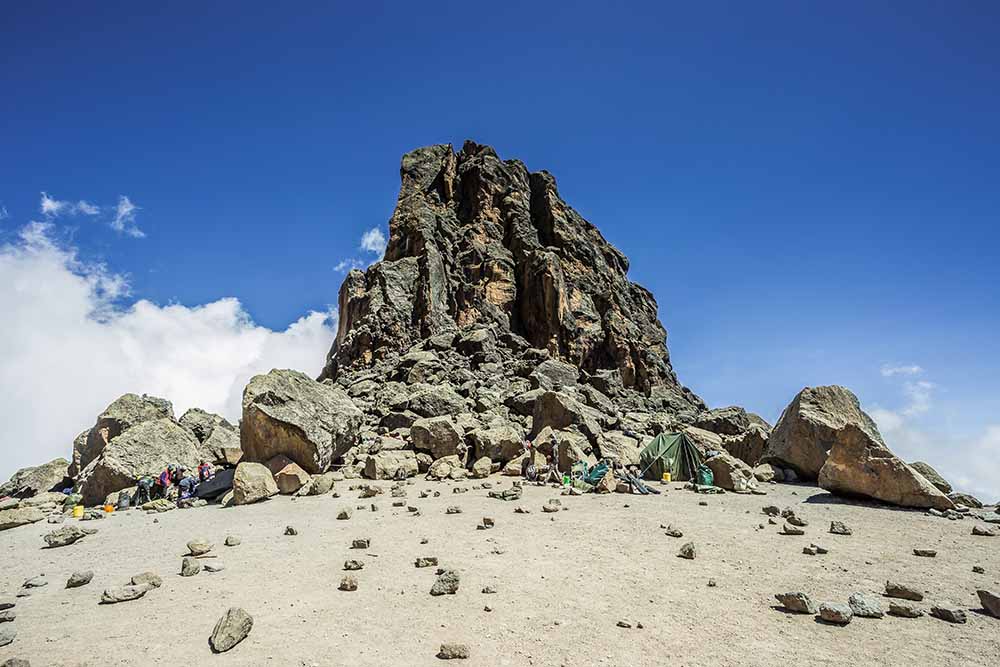
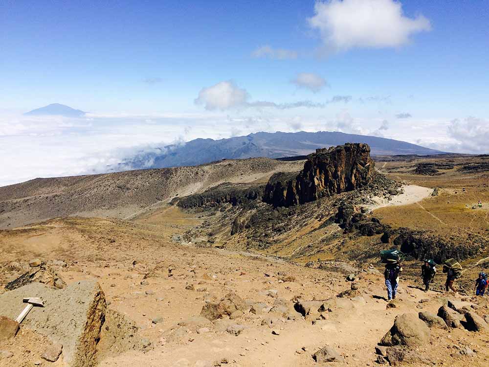
After breakfast you will leave Shira 2 Camp (3,900 m) and start your way to the key point of the route: Lava Tower (4,630 m). This section of the route has a lot of ascents and descents that end in a camp at over 4,600 meters. It might be difficult, and you may feel some discomfort, but in order to successfully acclimate to the altitude you have to spend at least 1 to 2 hours here, so this is where lunch will be.
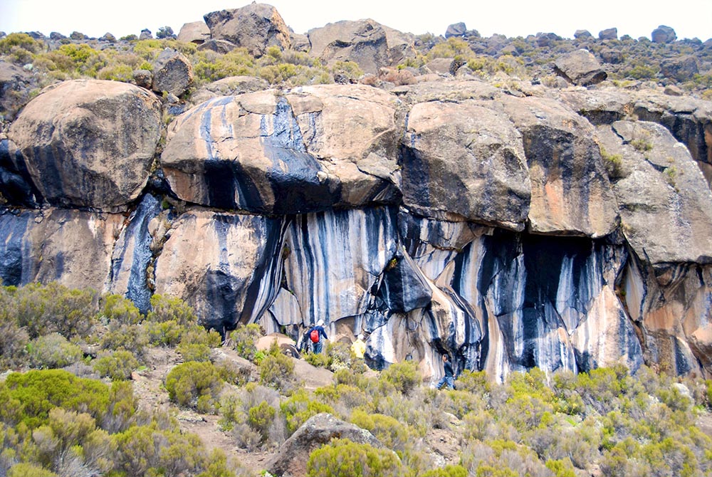
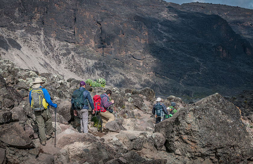
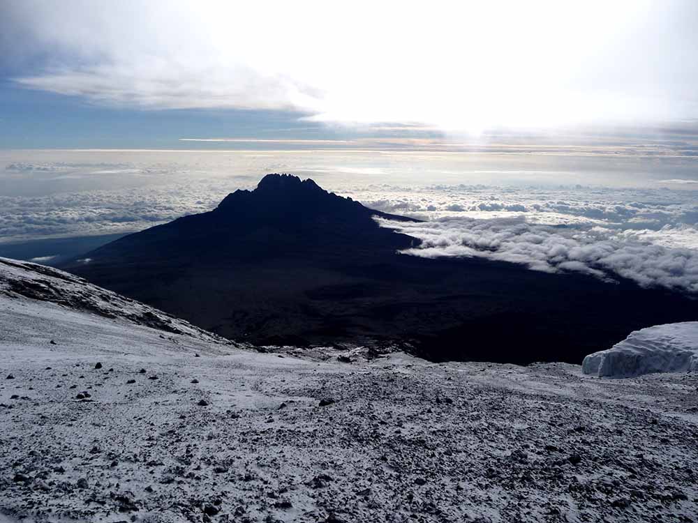
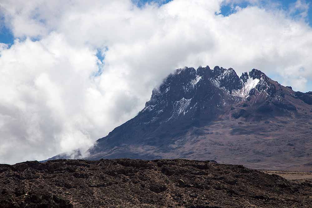
Then you will descend to Barranco Camp (3,960 m). Here you can see the famous Barranco Wall, impressive in both its massive size and steepness! Next day you will be climbing it, but don’t worry: it features a very simple hiking trail.
Note: If one or more participants feel sick, the group may refrain from passing the Lava Tower and adjust the route, following instead the road for porters. In this case you will not reach an altitude of 4,630 meters, getting up only to a maximum of 4,400 meters.[/mpc_icon_column][mpc_icon_column layout=”style_3″ alignment=”left” background_color=”#ffffff” padding_css=”padding:0px;” margin_divider=”true” title_font_preset=”mpc_preset_20″ title_font_color=”#365347″ title_font_size=”17″ title_font_line_height=”1.4″ title_font_transform=”uppercase” title_font_align=”left” title=”DAY 4: TREKKING FROM BARRANCO CAMP TO KARANGA CAMP” title_margin_divider=”true” title_margin_css=”margin-bottom:5px;” content_font_preset=”mpc_preset_1″ content_font_color=”#0a0a0a” content_font_size=”16″ content_font_line_height=”1.5″ content_font_align=”left” mpc_icon__icon_type=”image” mpc_icon__icon_image_size=”full” mpc_icon__icon_image=”3688″ mpc_icon__border_css=”border-radius:0px;” mpc_icon__padding_divider=”true” mpc_icon__margin_divider=”true” mpc_icon__margin_css=”margin-right:15px;” mpc_icon__mpc_tooltip__border_divider=”true” mpc_icon__mpc_tooltip__padding_divider=”true” mpc_divider__disable=”false” mpc_divider__width=”10″ mpc_divider__align=”left” mpc_divider__content_padding_divider=”true” mpc_divider__content_padding_css=”padding-top:0px;padding-right:0px;padding-bottom:0px;padding-left:0px;” mpc_divider__lines_color=”#dddddd” mpc_divider__padding_divider=”true” mpc_divider__padding_css=”padding-top:3px;padding-bottom:3px;” hover_padding_css=”padding:0px;”]
Change in Elevation:
- Barranco Camp (3,960 m)
- Karanga Camp (4,035 m)
- Hiking distance: 5 km
- Hiking time: 4 to 5 hours
Early wakeup, breakfast and the start of summiting Barranco Wall (we recommend you leave the camp as early as possible to avoid crowds of the other groups). Hiking up the gorge wall is not difficult and only takes around an hour. After the climb you can have a rest and take photos in front of the Kibo volcano.
Then you start a more difficult hike to Karanga Camp, which features numerous ascents and descents during the route, but don’t worry: our guides are experts at choosing an optimal pace for the group. After reaching the camp you will be offered warm lunch. After a couple of hours you will have to complete an acclimatization hike in the direction of Barafu Camp with a 200-meter gain in altitude, and then descent back down to the camp.
Acclimatization hike:
Change in Elevation:
- Karanga Camp (4,035 m)
- Destination point en route to Barafu Camp (4,270 m)
- Hiking distance: 2.5 km
- Hiking time: 1 to 2 hours
[/mpc_icon_column][mpc_icon_column layout=”style_3″ alignment=”left” background_color=”#ffffff” padding_css=”padding:0px;” margin_divider=”true” title_font_preset=”mpc_preset_20″ title_font_color=”#365347″ title_font_size=”17″ title_font_line_height=”1.4″ title_font_transform=”uppercase” title_font_align=”left” title=”DAY 5: TREKKING FROM KARANGA CAMP TO BARAFU CAMP” title_margin_divider=”true” title_margin_css=”margin-bottom:5px;” content_font_preset=”mpc_preset_1″ content_font_color=”#0a0a0a” content_font_size=”16″ content_font_line_height=”1.5″ content_font_align=”left” mpc_icon__icon_type=”image” mpc_icon__icon_image_size=”full” mpc_icon__icon_image=”3688″ mpc_icon__border_css=”border-radius:0px;” mpc_icon__padding_divider=”true” mpc_icon__margin_divider=”true” mpc_icon__margin_css=”margin-right:15px;” mpc_icon__mpc_tooltip__border_divider=”true” mpc_icon__mpc_tooltip__padding_divider=”true” mpc_divider__disable=”false” mpc_divider__width=”10″ mpc_divider__align=”left” mpc_divider__content_padding_divider=”true” mpc_divider__content_padding_css=”padding-top:0px;padding-right:0px;padding-bottom:0px;padding-left:0px;” mpc_divider__lines_color=”#dddddd” mpc_divider__padding_divider=”true” mpc_divider__padding_css=”padding-top:3px;padding-bottom:3px;” hover_padding_css=”padding:0px;”]
Change in Elevation:
- Karanga Camp (4,035 m)
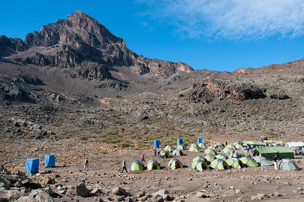
- Barafu Camp (4,640 m)
- Hiking distance: 6 km
- Hiking time: 4 to 5 hours
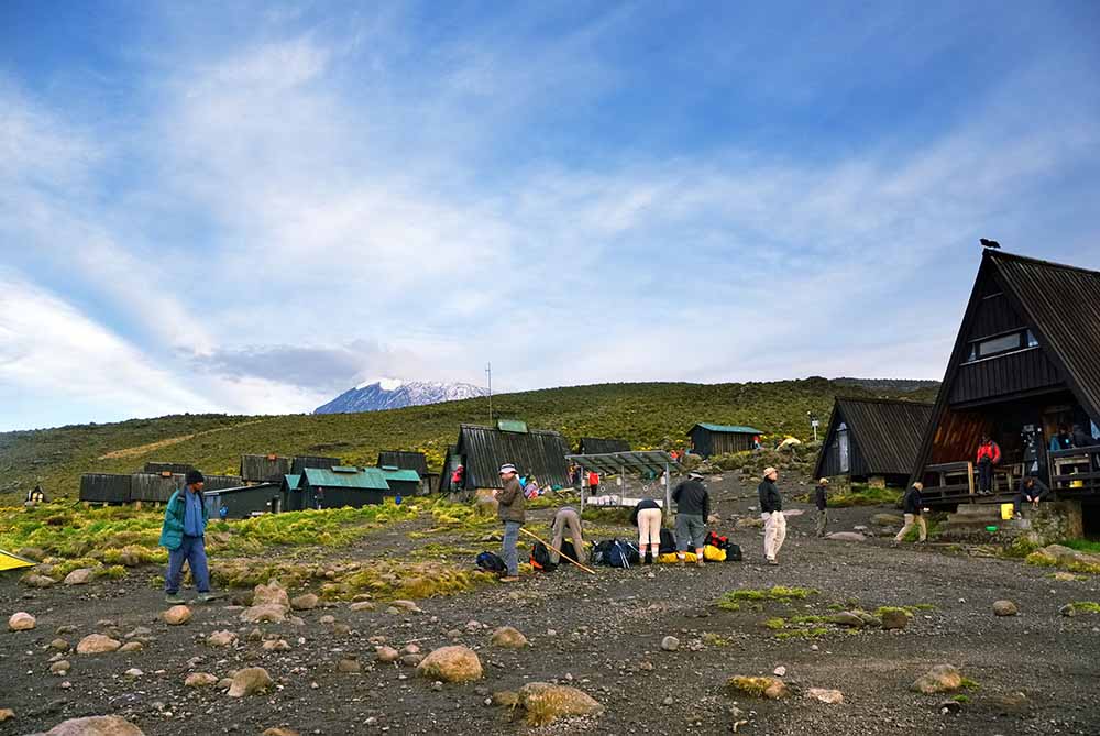
In the morning after breakfast you begin your way to Barafu Summit Camp (4,640 m), the starting point for a night summiting Uhuru Peak (5,895 m). Our team will set up a camp for you ahead of time, including tents and sleeping bags, so you can relax. After regaining strength, you have to complete an acclimatization hike towards the intermediate Kosovo Summit Camp (4,800 m) and then back to Barafu Camp, where you will be served a hot dinner. It is better to spend the remainder of the day resting and sleeping before night summiting.
Acclimatization hike:
- Change in Elevation:
- Barafu Camp (4,640 m)
- Kosovo Camp (4,800 m)
- Hiking distance: 2 km
- Hiking time: 1 to 2 hours
[/mpc_icon_column][mpc_icon_column layout=”style_3″ alignment=”left” background_color=”#ffffff” padding_css=”padding:0px;” margin_divider=”true” title_font_preset=”mpc_preset_20″ title_font_color=”#365347″ title_font_size=”17″ title_font_line_height=”1.4″ title_font_transform=”uppercase” title_font_align=”left” title=”DAY 6: ASCENT TO UHURU PEAK AND DESCENT TO MILLENNIUM CAMP” title_margin_divider=”true” title_margin_css=”margin-bottom:5px;” content_font_preset=”mpc_preset_1″ content_font_color=”#0a0a0a” content_font_size=”16″ content_font_line_height=”1.5″ content_font_align=”left” mpc_icon__icon_type=”image” mpc_icon__icon_image_size=”full” mpc_icon__icon_image=”3688″ mpc_icon__border_css=”border-radius:0px;” mpc_icon__padding_divider=”true” mpc_icon__margin_divider=”true” mpc_icon__margin_css=”margin-right:15px;” mpc_icon__mpc_tooltip__border_divider=”true” mpc_icon__mpc_tooltip__padding_divider=”true” mpc_divider__disable=”false” mpc_divider__width=”10″ mpc_divider__align=”left” mpc_divider__content_padding_divider=”true” mpc_divider__content_padding_css=”padding-top:0px;padding-right:0px;padding-bottom:0px;padding-left:0px;” mpc_divider__lines_color=”#dddddd” mpc_divider__padding_divider=”true” mpc_divider__padding_css=”padding-top:3px;padding-bottom:3px;” hover_padding_css=”padding:0px;”]
Change in Elevation:
- Barafu Camp (4,640 m)
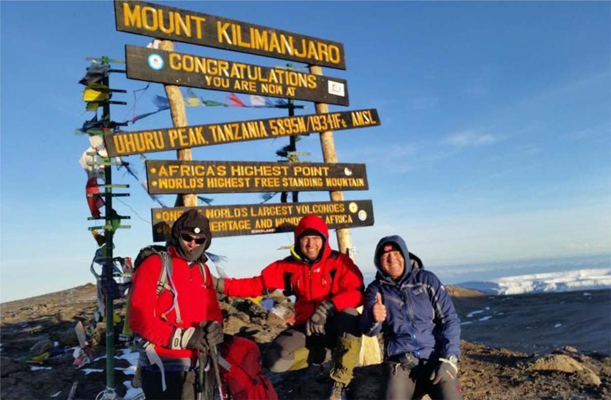
- Uhuru Peak (5,895 m)
- Millennium Camp (3,820 m)
- Hiking distance: 15 km
- Hiking time: 8 to 12 hours
Departure from Barafu Camp (4,640 m) at night and the start of summiting Kilimanjaro: Uhuru Peak (5,895 m). Technically the climb is relatively simple; however, the most challenging part is the high altitude. Each pair of climbers will get a personal guide for the entire ascent to monitor your physical and mental conditions. After your successful ascent to Uhuru Peak, you can descend to the nearest glacier if desired. Then you will return to Barafu Camp and after a 2-hour rest continue your descent to Millennium Camp (3,820 m).
Note: Don’t forget that 90% of all accidents occur during the descent, including all broken arms and legs. Please pay attention to your feet, as there is a high risk of damaging your toenails.[/mpc_icon_column][mpc_icon_column layout=”style_3″ alignment=”left” background_color=”#ffffff” padding_css=”padding:0px;” margin_divider=”true” title_font_preset=”mpc_preset_20″ title_font_color=”#365347″ title_font_size=”17″ title_font_line_height=”1.4″ title_font_transform=”uppercase” title_font_align=”left” title=”DAY 7: DESCENT FROM MILLENNIUM CAMP TO MWEKA GATE” title_margin_divider=”true” title_margin_css=”margin-bottom:5px;” content_font_preset=”mpc_preset_1″ content_font_color=”#0a0a0a” content_font_size=”16″ content_font_line_height=”1.5″ content_font_align=”left” mpc_icon__icon_type=”image” mpc_icon__icon_image_size=”full” mpc_icon__icon_image=”3688″ mpc_icon__border_css=”border-radius:0px;” mpc_icon__padding_divider=”true” mpc_icon__margin_divider=”true” mpc_icon__margin_css=”margin-right:15px;” mpc_icon__mpc_tooltip__border_divider=”true” mpc_icon__mpc_tooltip__padding_divider=”true” mpc_divider__disable=”false” mpc_divider__width=”10″ mpc_divider__align=”left” mpc_divider__content_padding_divider=”true” mpc_divider__content_padding_css=”padding-top:0px;padding-right:0px;padding-bottom:0px;padding-left:0px;” mpc_divider__lines_color=”#dddddd” mpc_divider__padding_divider=”true” mpc_divider__padding_css=”padding-top:3px;padding-bottom:3px;” hover_padding_css=”padding:0px;”]
Change in Elevation:
- Millennium Camp (3,820 m)
- Mweka Gate (1,650 m)
- Hiking distance: 12 km
- Hiking time: 4 to 5 hours
The camp is situated in a tropical rainforest. When you wake up, you will feel relief from the reduction of the height and the satisfaction of reaching the summit. After a warm breakfast, you will head for the park’s exit: Mweka Gate (1,650 m). After your descent the whole group will gather to congratulate you, followed by offering you a chance to share your opinions on the climb in the guestbook. Lastly, we will present you with your commemorative certificates in our office and provide you a transfer back to the hotel.
Note: Don’t forget that 90% of all accidents occur during the descent, including all broken arms and legs. Please pay attention to your feet, as there is a high risk of damaging your toenails.[/mpc_icon_column][mpc_icon_column layout=”style_3″ alignment=”left” background_color=”#ffffff” padding_css=”padding:0px;” margin_divider=”true” title_font_preset=”mpc_preset_20″ title_font_color=”#365347″ title_font_size=”17″ title_font_line_height=”1.4″ title_font_transform=”uppercase” title_font_align=”left” title=”OPTIONAL DAY” title_margin_divider=”true” title_margin_css=”margin-bottom:5px;” content_font_preset=”mpc_preset_1″ content_font_color=”#0a0a0a” content_font_size=”16″ content_font_line_height=”1.5″ content_font_align=”left” mpc_icon__icon_type=”image” mpc_icon__icon_image_size=”full” mpc_icon__icon_image=”3688″ mpc_icon__border_css=”border-radius:0px;” mpc_icon__padding_divider=”true” mpc_icon__margin_divider=”true” mpc_icon__margin_css=”margin-right:15px;” mpc_icon__mpc_tooltip__border_divider=”true” mpc_icon__mpc_tooltip__padding_divider=”true” mpc_divider__disable=”false” mpc_divider__width=”10″ mpc_divider__align=”left” mpc_divider__content_padding_divider=”true” mpc_divider__content_padding_css=”padding-top:0px;padding-right:0px;padding-bottom:0px;padding-left:0px;” mpc_divider__lines_color=”#dddddd” mpc_divider__padding_divider=”true” mpc_divider__padding_css=”padding-top:3px;padding-bottom:3px;” hover_padding_css=”padding:0px;”]
Spend an Extra day at Mti Mkubwa Camp (2780m) for better acclimatization.
[/mpc_icon_column][/mpc_connected_icons][[/vc_column][/vc_row]